桃園大圳灌溉區流水網系空間支援系統(1)第一至第八支線部分
- Plan Name
- Spatial Supporting System of Water Ways in Taoyuan Irrigation Channel Network (1)Subchannel No.1 to Np. 8
- 計畫編號
- 86-4-01
- 類別
- 農業環境保育類
- 摘要
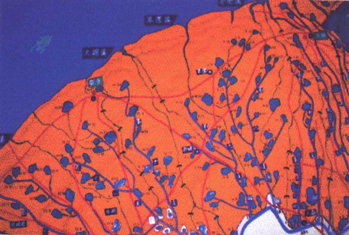
- 本研究作業分為四部分。 第一部分是利用地理資訊系統數化桃園大圳灌溉區第一至第八支線範圍五千分之一地圖。 第二部分是商請桃園農田水利會協助,由現場各工作站初步協繪灌溉網系,直接繪入五千分之一地圖,再將五千分之一比例全區地圖依經建版五千分之一地圖圖幅規格,分開繪製,製成可以分開或合併之地圖基圖。 第三部分是利用衛星定位儀,修正統一圖幅規格的地圖基圖上的灌溉網系及其交接或轉合位置,再度修補成為正確灌溉網系圖。並儘可能以數值照相機攝取重要點位相片。第四部分是結合灌溉系統的屬性資料、圖形資訊與相片資訊利用電腦軟體系統開發出支援系統的雛形,己能具備查詢、編輯、展示、印出、轉檔等功能。查詢包括地圖上查詢資料庫及相片,座標,全貌,面積、長度、寬度等。編輯包括新建資料,修正與刪除資料、改換照片,刪除照片。展示包括由資料庫及數化地圖互相指認,照片展示與資料展示。印出相片,印出查詢後結果資料,印出指定範圍的地圖。轉檔包括設定路徑,將相片檔,資料庫檔,及數化地圖檔轉移。未來在地圖完全補全後,計算的功能會加強,除了計算件數,長度,面積,寬度等資料外,尚可以以後配合水文資料庫之運作進一步繪製簡易統計圖缺水情形等資料。本報告因農田水利會工作站人員參與時間尚淺,地圖作業乃不夠完整,乃有必要針對某一特定主題、加強地圖修正。並對地圖上各種重要資訊據點加攝正確相片。資料庫、相片與地圖之連續才能完整。待地圖修正至較完善地步,支援系統才能發揮功能。本期完成的支援系統雛形僅提供功能方向定位,以供進一步修正時一併修正。 本報告共分為三部分。第一部分是本報告主題部分,共提繳150份。附有五千分之一基圖組合圖檔與第一灌溉工作站管轄區圖檔。第二部分乃桃園大圳灌溉區範圍五千分之一數化圖計 張,共提繳十份為本報告第一附件。基金會如有需要得隨時要求加印。第三部分為支援系統雛形,光碟展示版共150片,以為本報告第二附件。
- Abstract
- This study is partitioned into four parts. The first part prepared the digited map, with a scale of 1:5000, for subchannels 1 to 8 of Tao-Yuan Irrigation Authority using GIS. The second part grided the digited map into regular size of 50.5cm×55.5cm and made up the detailed information of topologic features. The third part added the irrigation networks and photographs of important spots and further edited such feature in the maps. GIS worked in the last step to combine the attribute data, map information and photographs to build up a prototype of a supporting system. The system include functions, such as acquisition, edit, display, print, file transfer. Acquisition worked on the information of photographs, coordinates, full pictures, areas, lengths and widths. Edit worked on building, modifying, removing and changing. Display included the cooperation between the digited map and database, recognization, photograph show, and tabulating data, printing, and defining. File transfer included defining the path and transferring the photograph file, data file, the digited map file. Any further improvement will add the function as well as its efficiency.
- 計畫主持人
- 梁昇
- Project Director
- Sheng Liang
- 關鍵字
- 流水網系空間支援系統、地理資訊系統數化地圖
- Keywords
- Spatial Supporting System of Water Ways、Digited Map
- 成果報告